Ground Penetrating Radar Surveys
Non-Intrusive Surveys for Sites and Structures
Get a Free Quote From Us Today!
We aim to get back to you in 24 hours.
At Ground Penetrating Radar Surveys, we provide accurate and non-destructive subsurface surveying for construction sites, buildings, and structures across the UK. Our ground penetrating radar (GPR) technology effectively identifies underground utilities, reinforcement, voids, and other hidden features essential for construction and development projects. We serve a wide range of clients, from construction companies to infrastructure developers, ensuring thorough site assessments for safe and successful projects.
Contact us today to learn more about our services or to request a survey.
Who Is Ground Penetrating Radar Surveys?
At Ground Penetrating Radar Surveys, we specialise in providing comprehensive subsurface surveying services. Our mission is to deliver precise and reliable ground-penetrating radar surveys that assist clients in making informed decisions about their construction and development projects.
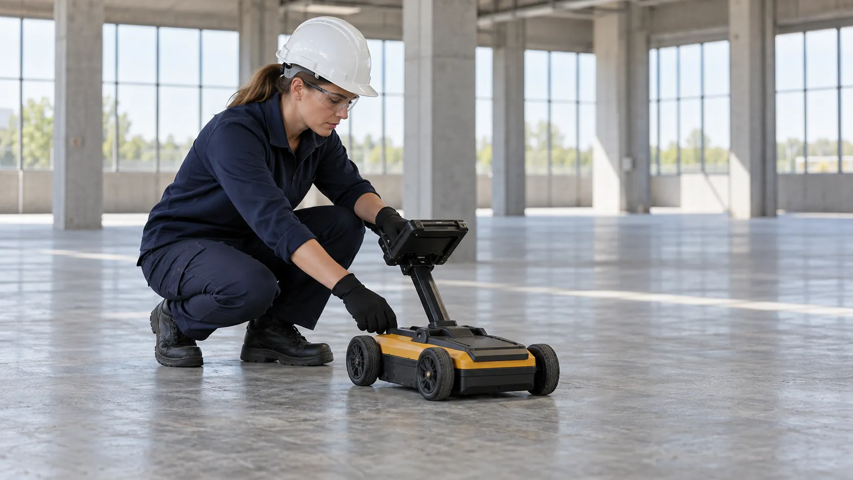
We use sophisticated GPR equipment such as the SIR 4000 and the RD1500, which are adept at detecting a variety of underground structures including utilities, voids, and rebar within concrete. Our team is skilled in interpreting data to identify potential hazards like buried tanks or cables, crucial for construction safety and compliance with standards like PAS 128.
Whether you’re planning a new build, renovation, or infrastructure project, our surveys help prevent costly damages and project delays. We service a wide range of industries, including civil engineering, archaeology, and environmental consultancy.
Contact us today to discuss your project requirements and how we can support your success.
What Services Does the company Ground Penetrating Radar Surveys Provide?
At Ground Penetrating Radar Surveys, we offer a core set of services essential for subsurface exploration, using equipment such as the 400 MHz and 1000 MHz antenna systems to ensure precise data collection. These services cater to various industries such as construction, civil engineering, and archaeology:
- GPR Surveys for Utilities: Identify and map underground utilities like gas, water, and electrical lines to avoid costly disruptions. Our surveys adhere to industry standards like PAS 128 for utility detection, mitigating the risk of accidental damage.
- Structural Reinforcement Scans: Detect reinforcement structures, such as steel rebar and post-tension cables within concrete and other materials, using advanced scanning methods. We ensure compliance with engineering guidelines and provide detailed scanning reports.
- Void and Anomaly Detection: Locate voids and anomalies that could affect structural integrity, whether under roadways or within building foundations. Our scanning can help prevent structural failures and is useful in restoration projects.
- Site Assessment and Mapping: We conduct comprehensive assessments for construction and development planning, providing detailed maps that highlight underground features. Our mapping supports project managers in making informed decisions to enhance site safety and efficiency.
These services are supported by our experienced team of GPR technicians who are skilled in interpreting complex subsurface data. Contact us to learn how we can assist with your specific project requirements.
When Is Ground Penetrating Radar Needed?
Ground penetrating radar services are crucial when undertaking construction or development projects where the subsurface condition could impact outcomes. We use this non-invasive method to identify underground utilities and voids, which can help prevent costly delays and potential hazards.
Our services are necessary before excavation to prevent damage to hidden utilities and during structural assessments to verify the integrity and safety of existing formations like tunnels or bridge foundations. Additionally, our GPR systems can detect varying soil densities and groundwater levels, providing valuable insights for environmental assessments.
We also assist in historic preservation efforts by mapping ancient subsurface features without disturbance, allowing archaeologists to locate unmarked graves or lost artefacts. This reduces the risk of damaging invaluable cultural resources.
Contact us today to learn how our expertise can enhance the safety, efficiency, and success of your next project.
Get a Free No Obligation Quotation Today
How Does Ground Penetrating Radar Surveys Work?
Our process is straightforward and efficient, ensuring that we meet the specific needs of clients from different sectors, such as construction, archaeology, and civil engineering. Initially, during the consultation phase, we discuss the project requirements and objectives, giving special consideration to site-specific challenges like soil composition or environmental conditions.
Following this, our team performs a site survey using ground penetrating radar equipment calibrated to detect various subsurface elements. We use GPR systems with frequencies ranging from 100 MHz to 2.6 GHz to offer a balance between depth penetration and resolution.
Next, in the data analysis phase, we interpret the collected radar data meticulously to identify utilities like cables and pipelines, structures such as foundations, and any subsurface voids or anomalies.
Finally, we compile our findings into detailed reports. These reports include CAD drawings and 3D visualisations, along with practical recommendations tailored to the client’s specific project needs.
If you need a reliable subsurface analysis, contact us today to discuss how we can assist with your project.
Who Does Ground Penetrating Radar Surveys Help?
We provide our expertise to a diverse clientele, including construction and civil engineering firms, infrastructure developers, and archaeological teams. These entities rely on our ground penetrating radar (GPR) technology for non-destructive subsurface investigations, allowing them to detect buried utilities, conduits and rebar in concrete structures.
Utility providers benefit from our services through accurate mapping of underground assets such as water mains, gas lines, and electrical cables, which aids in efficient infrastructure maintenance and improvement. Archaeologists use our GPR surveys to locate historical artefacts or burial grounds without excavation, preserving the integrity of the sites.
Property managers often engage us to conduct structural assessments, especially in older buildings, to identify any potential anomalies or damage within concrete, such as voids and delaminations. Contact us to discuss how we can assist your project with precise data and insights.
How Quickly Can Ground Penetrating Radar Surveys Respond?
We understand that timely completion of your project is critical, so we strive to conduct surveys swiftly, often scheduling them within a few days of your initial contact. Our experienced team can quickly assess project requirements, whether it’s for a construction site, environmental study, or utility mapping.
For urgent cases, we try to accommodate immediate requests, depending on current availability and logistical factors.
We use efficient scheduling software to coordinate our resources effectively and ensure prompt service. For larger-scale projects, such as those involving multiple survey sites, we may need additional time for planning, but we work closely with you to minimise any delays.
If you have specific timelines or unique constraints, feel free to contact us to discuss how we can meet your needs efficiently.
How Does Ground Penetrating Radar Surveys Ensure Quality and Compliance?
We ensure quality and compliance by employing advanced GPR techniques in accordance with industry standards such as PAS 128 for utility detection and mapping. Our team is trained to use both 2D and 3D GPR systems to capture high-resolution subsurface images, which help in identifying utilities, voids, and structural anomalies.
By calibrating our equipment regularly and performing checks in line with BS EN 302066, we maintain the accuracy of our findings.
Our team remains updated with best practices and follows stringent quality control measures during every survey. We also adhere to regulations relevant to subsurface surveying, such as the Health and Safety Executive (HSE) guidelines, providing our clients with reliable and compliant insights.
Clients from construction, archaeology, and environmental consultancy rely on us for thorough assessments, ensuring safe and informed decision-making. Contact us to discuss how we can support your project with precise GPR surveying.
Request a free quote
Why Choose Ground Penetrating Radar Surveys?
We offer unmatched expertise in subsurface surveying, using ground penetrating radar technology ideal for applications across a range of sectors including construction, archaeology, and environmental studies.
- Precision and Reliability: Our high-frequency radar systems generate detailed images of subsurface structures, allowing for precise location of utilities, voids, and other hidden elements.
- Expert Interpretation: Our team of trained geophysicists and engineers is skilled in analysing and interpreting complex geophysical data. By using industry-standard software such as RadExplorer and GSSI’s RADAN, we ensure accurate insights.
- Comprehensive Reporting: We provide detailed documentation, including 3D models and CAD drawings, to aid in informed decision-making for engineers and project managers.
- Commitment to Safety: Our practices adhere to health and safety standards such as HSG47, prioritising site integrity and the safety of all personnel.
Whether you are planning a new infrastructure project or need to identify potential site hazards, our services offer invaluable assistance.
Frequently Asked Questions
What is ground penetrating radar?
Ground penetrating radar is a non-invasive technique used to explore subsurface features by sending electromagnetic signals into the ground and analysing the reflected data.
Can GPR detect all underground features?
While GPR is highly effective, its success depends on the specific conditions of the site, such as soil type and feature material. It can generally detect most utilities and voids.
How long does a typical survey take?
The duration of a survey varies with the area size and complexity, but most sites are typically surveyed and reported within one to two days.
Is GPR safe to use on all sites?
Yes, ground penetrating radar is a safe, non-destructive method suitable for urban and rural sites alike, posing no risk to structures or the environment.
What kind of projects benefit most from GPR surveys?
GPR surveys are most beneficial for construction, infrastructure development, archaeological exploration, and utility mapping projects where understanding subsurface conditions is critical.
Get a Free Quote
Our team at Ground Penetrating Radar Surveys is ready to assist with your project needs.
speak with our team today
What People are Saying About Us
★★★★★
“Clear, easy-to-read radar results from Ground Penetrating Radar Surveys. Very happy with the whole job.”
Thomas Ellison
London
★★★★★
“Chuffed with the scan from Ground Penetrating Radar Surveys, it was all over quickly and without any mess. Would recommend them to anyone.”
Stuart Calloway
London
★★★★★
“The report from Ground Penetrating Radar Surveys was far clearer than I expected, with colour-coded depth maps. The team made it easy to share with our consultants.”
Chloe Brennan
London
★★★★★
“The Ground Penetrating Radar Surveys team were an absolute pleasure, so patient and thorough. I could not have been happier!”
Oliver Brennan
London
Our Locations
We are proud to work nationally across the UK, allowing us to ensure we can provide services to you.
For a full list of counties we cover in the UK, see below.